CHAPTER 3: SURVEY MAPS AND COUNTY RECORDS DISCOVERY
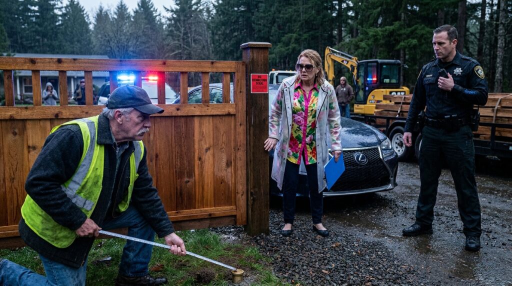
Gareth didn’t answer Brenda’s phone call to the sheriff. He walked back to his Ford’s open tailgate, his boots leaving thick, wet depressions in the gravel where the mud was beginning to turn soft under the drizzle. Cold water dripped off the brim of his canvas cap, landing squarely on the worn leather accordion folder he pulled from behind the bench seat.
Inside, the scent of tobacco and machine oil clung to the thick, yellowed paper—a smell that had filled Silas’s shop for four decades.
“You can pull all the paper you want out of that old truck, Gareth,” Brenda called over the low pulse of her Lexus engine. She stood under her large umbrella, her floral tunic vibrant against the bleak overcast sky. “It doesn’t alter the fact that Crown Estates is a registered planned community with recorded buffer zones. You’re holding personal relics. I’m holding municipal authority.”
Gareth spread the top document flat against the cold, damp steel of the tailgate. It was a hand-drawn 1984 survey map, executed on heavy vellum that had turned the color of dried wheat over thirty-eight years. At the bottom right corner, sealed in red ink, was the raised seal of the Clackamas County Planning Director.
He didn’t argue. He pulled his phone from his pocket with his left hand, holding the camera lens six inches above the vellum, recording the raised seal, the dates, and the sharp ink lines that laid out Lot 4.
“Look at the corner post mark, Toby,” Gareth said, his voice carrying clearly past Brenda to the operator still waiting by the idle excavator. “Section 12, Township 2 South, Range 3 East. Silas paid forty-two hundred dollars to have the county surveyor set three brass caps along this ditch line in November of eighty-four. Two weeks before the subdivision developers ever bought the timber rights to the south.”
Toby leaned over the excavator’s low door, peering down at the drawing. “Is that the cap right under the fence anchor?”
“Right under the concrete footer,” Gareth confirmed. He turned a page in the accordion file, laying out a stack of receipts held together by a rusted paperclip. “And these are thirty-eight consecutive years of property tax payments made to Clackamas County. Every April, Silas walked into the courthouse in Oregon City and paid cash. Since he passed, I’ve paid online. Not a single year delinquent. Not a single easement granted to Crown Estates.”
Brenda took two steps toward the truck, her umbrella tilting back just enough for the rain to catch the edges of her oversized sunglasses. “A tax payment proves you paid taxes, Gareth. It doesn’t prove where your driveway boundary sits relative to a modern public access update. The 2018 county master plan redrew the access corridors for watershed protection. You’re referencing a map drawn when Highway 212 was two lanes.”
“The county can’t take private fee-simple land for an HOA buffer without an eminent domain condemnation,” Gareth said calmly. He reached down and smoothed out the green-covered document Brenda had handed him earlier—the one with the suspiciously bright silver staples.
He flipped to the third page, where a scaled diagram purported to show the “Crown Estates Greenway Extension.” High up in the margin, printed in microscopic light gray ink, was a tiny logo: Cascade Drafting Services, LLC.
Gareth knew the name. Every contractor in the county knew it. Cascade Drafting had lost its civil license in 2021 after a scandal involving falsified site surveys for commercial developers in Gresham.
“This isn’t a county map,” Gareth said, his thumb tracing the faint watermark beneath the border lines. “This is a private site plan produced by a third-party draftsman. It has no county recording stamp, no parcel identification number, and no signature from the land use board.”
Brenda’s posture went rigid. The tight, dismissive curve of her mouth flattened into a thin line, her knuckles whitening where she gripped the handle of her umbrella. “That map was prepared for the association’s legal counsel. It reflects the zoning interpretation our board operates under.”
“It reflects what you paid a revoked drafting firm to draw on a computer,” Gareth replied, his voice remaining low, steady, and unhurried. He took a high-resolution photo of the watermark, then flipped back to the first page to capture the unblemished silver staples. “And you used it to threaten a commercial driver, slap an enforcement notice on my gate, and order a contractor to destroy private property.”
Down the road, the faint wail of a siren cut through the steady patter of the rain, growing louder as it navigated the curves of Stony Point Lane.
Brenda turned toward the sound, her chin rising as she adjusted her blue clipboard. “That will be Deputy Rayford. Let’s see how much weight your thirty-year-old paper carries when law enforcement arrives.”
Gareth didn’t close the accordion folder. He smoothed the 1984 survey map flat against the steel tailgate, weighed down the corners with his brass folding rule and a heavy iron wedge, and waited as the white-and-black patrol car rounded the bend, its lights flashing silently against the wet pavement.